Tutorial: Export Image and Worldfile from ArcGIS
The Imagemap Generator needs a georeferenced Jpeg file (Jpeg and World-File) and a Shapefile containing the geometry data and the URL for the clickable areas.
You can find examples for the input-files here
Next you will see how to produce these files with ArcGIS (Sorry for the German Screenshots).
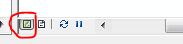
- Export the map. First switch the view in ArcGIS to see the data frame
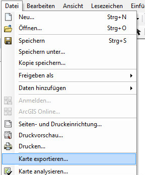
- Next choose file -> Export map
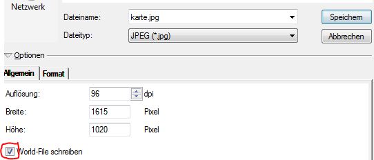
- Tick write World-File. This will generate the image of your map and the World-File.
- Project the shapefile to the same georeference as your dataframe. Otherwise the coordinates in the Shapefile do not match the Worldfile.
Use the Toolbox under Data Management Tools -> Project
- Exporting the Shapefile is not necessary, just find the .shp and .dbf files in your directory.
Back to Imagemap Generator